

 Sign in
 Sign up


Why GPS Drones Crash or Get Lost: What Beginners Often Get Wrong
Why GPS Drones Crash or Get Lost: What Beginners Often Get Wrong
Most lost-drone stories do not begin with one dramatic failure. They begin with a small problem that turns into another.
Learn how GPS status, Home Point, RTH, wind, battery, obstacles, orientation and pilot reactions can combine—and where you can break the chain before a small problem becomes a lost drone.
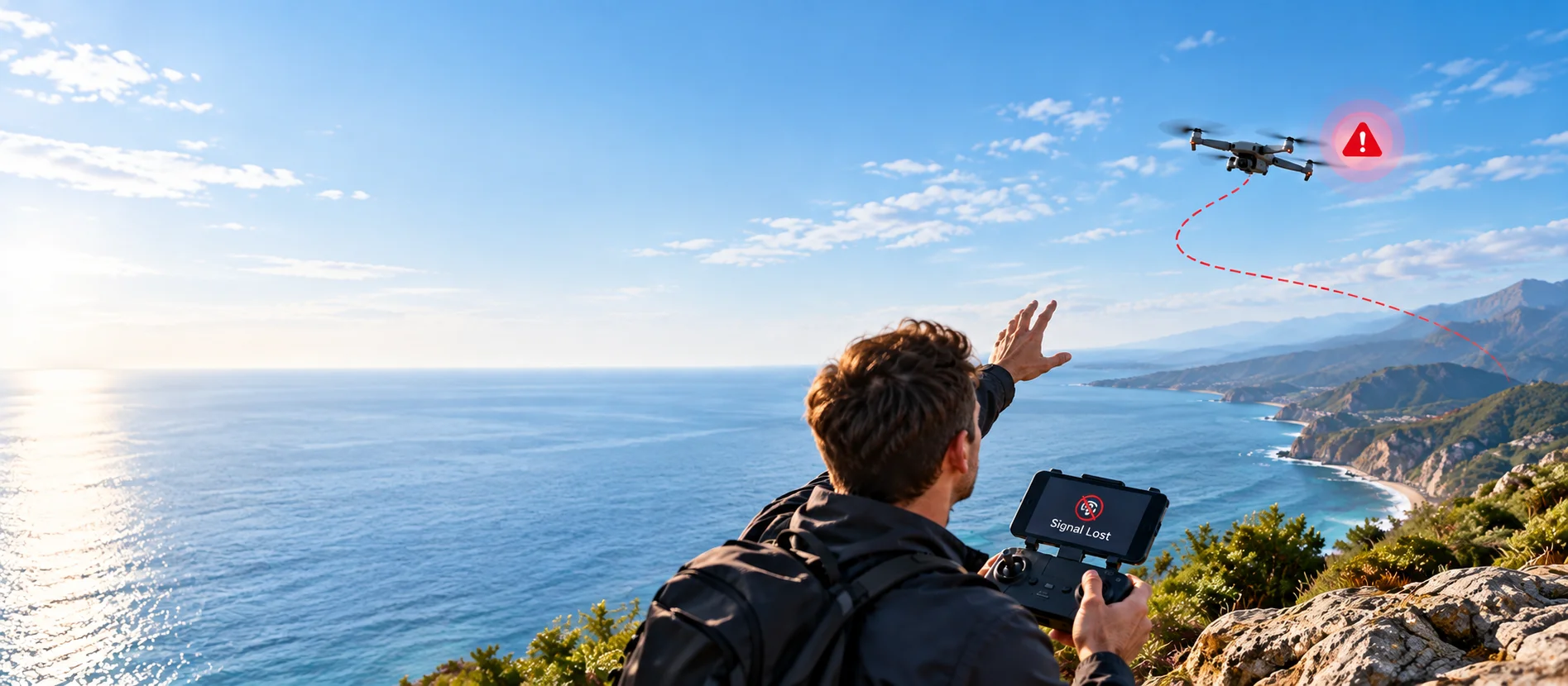
When a GPS drone crashes or disappears, the story is often reduced to one sentence: “It flew away,” “RTH failed,” or “I lost signal.”
In reality, the loss often begins earlier. A Home Point may not have been confirmed. A tailwind may carry the drone farther than expected. The return route may cross an obstacle. Battery reserve may disappear while fighting a headwind. Then, once something feels wrong, rushed control inputs can make the situation worse.
This guide explains how those small problems can stack into a crash or lost drone—and where a pilot can break the chain. GPS behavior, RTH logic, failsafe settings and sensor coverage vary by model, so always use your drone’s manual as the final reference.
A drone loss often starts before the moment that feels like the emergency.
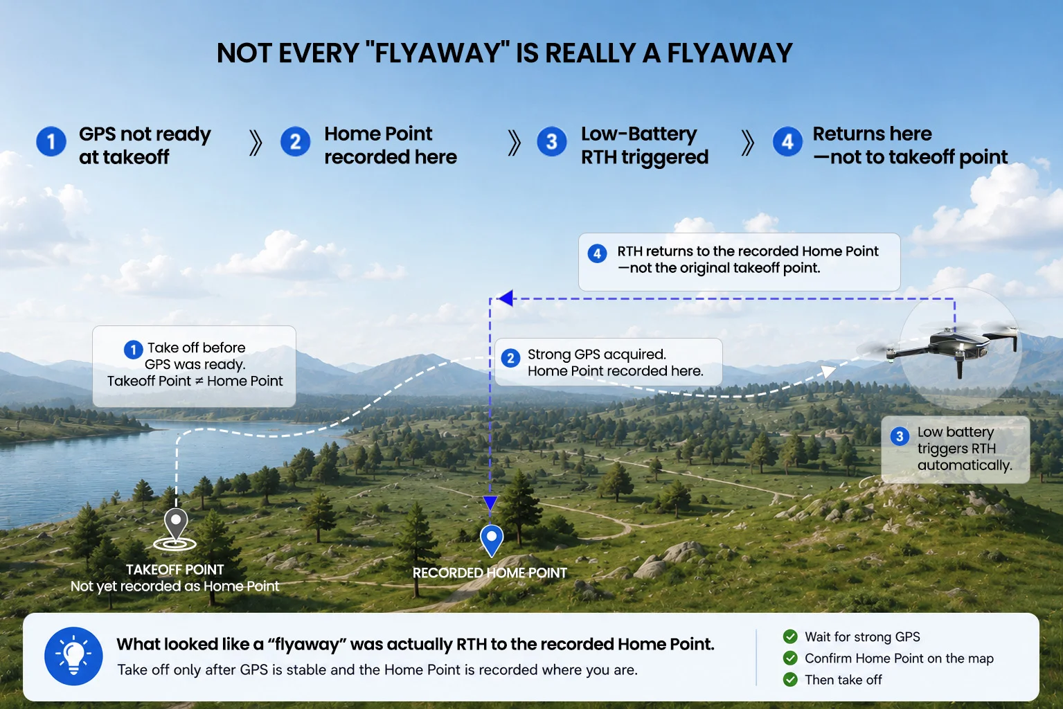
Not Every “Flyaway” Is Really a Flyaway
To a pilot, a drone moving in an unexpected direction can look like the aircraft has stopped listening. But unexpected movement does not automatically mean the drone has suffered a true uncontrolled “flyaway.”
The aircraft may be responding to wind, returning toward a recorded Home Point, reacting to a battery or signal-loss condition, or simply moving in a direction the pilot did not expect because orientation has changed.
Before assuming the drone has failed, ask: what mode is it in, where is its Home Point, and what is it trying to do?
GPS Knows Where the Drone Is—Not Whether Your Flight Is Safe
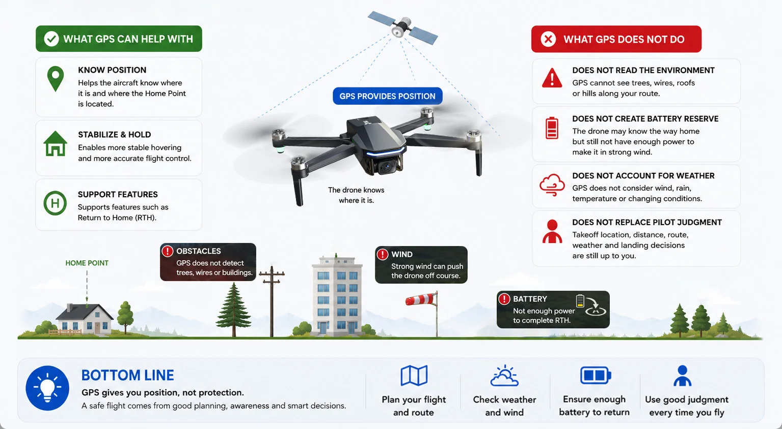
GPS-assisted flight can help an aircraft estimate its position, hold position more steadily and support functions such as Return to Home. That is extremely useful—but it solves only part of the problem.
GPS Can Help With Position
A usable satellite position can help the aircraft understand where it is and where a recorded Home Point is located.
GPS Does Not Read the Environment for You
GPS alone does not tell the drone that a tree, wire, roof or hillside lies along the route you chose.
GPS Does Not Create Battery Reserve
The aircraft may know the direction home while still lacking enough power to complete the return in difficult wind.
GPS Does Not Replace Pilot Judgment
Takeoff location, flight distance, return route, weather and landing decisions still matter.
If you are still learning GPS status, first takeoff and basic orientation, start with How to Fly a GPS Drone for the First Time.
The Home Point May Not Be Where You Think It Is
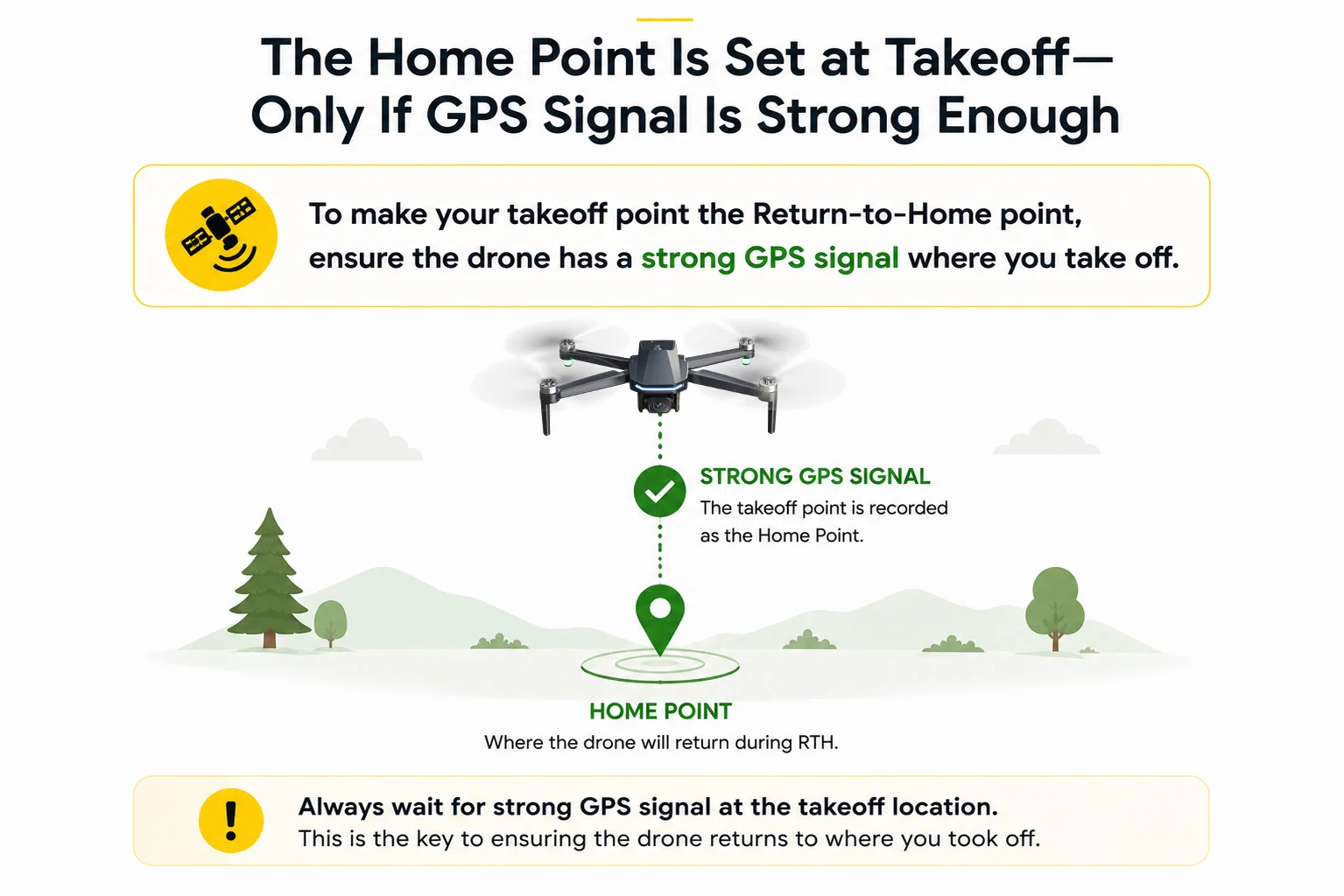
One of the most dangerous misunderstandings is assuming that “home” always means the place where you are standing. On many GPS drones, the Home Point is a recorded position associated with the aircraft’s GPS-ready state and takeoff.
If the aircraft leaves before the required GPS status is ready, the stored Home Point may not match the location the pilot has in mind. RTH can then behave exactly as programmed and still look completely wrong from the pilot’s perspective.
RTH Can Work Correctly and Still Get You Into Trouble
Return to Home is a recovery tool, not a guarantee of a collision-free or battery-safe trip home. The important question is not only “Will RTH activate?” but also “What happens after it activates?”
01 · Unexpected Home Point
The aircraft returns toward the point it recorded—not necessarily the point the pilot expected.
02 · Unsafe Return Altitude
A return altitude that is too low may not clear obstacles. An unnecessarily high return can require extra climbing and may encounter different wind.
03 · Direct Return Path
A route that was safe while flying around obstacles may not be safe if RTH takes a more direct path toward home.
04 · Not Enough Energy
RTH can point the aircraft home, but it cannot guarantee enough remaining battery to overcome wind and complete the return.
RTH can be functioning normally while the overall flight plan is still unsafe.
For Home Point, return path, RTH altitude, signal-loss behavior and practice guidance, read Drone Return to Home Explained: How RTH Really Works.
The Wind Up There May Be Very Different
Wind at flight altitude can be stronger—or come from a different direction—than it feels near the ground. A tailwind can make the outbound leg feel easy and build distance quickly; turn around, and that same wind becomes a headwind that slows progress home.
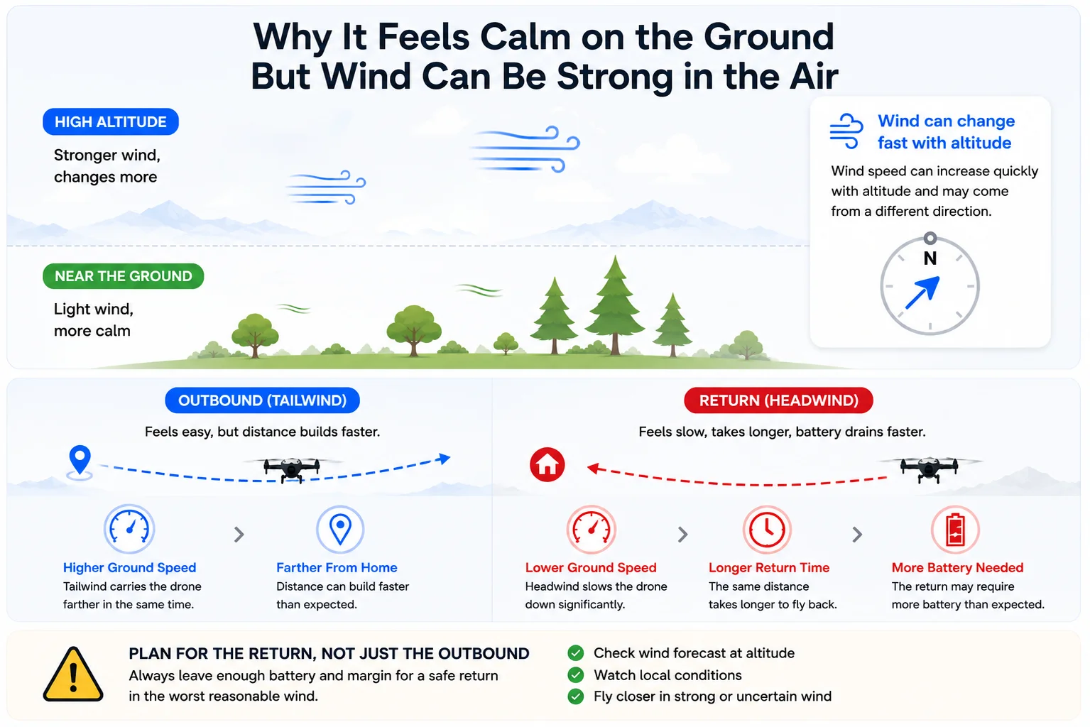
30% battery remaining does not mean 30% of your outbound distance is safely available. The return still has to account for wind, distance, altitude changes, repositioning and landing reserve.
Sensors Have Limits
Some drones include obstacle sensing or other vision-based positioning features. These systems can be useful, but they should never be treated as an invisible protective bubble around the aircraft.
Thin Branches & Wires
Thin obstacles can be difficult to see and may challenge some sensing systems.
Transparent or Reflective Surfaces
Glass and reflective surfaces may be difficult for some sensors to interpret reliably.
Low Light or Strong Backlight
Vision-based systems may perform differently in poor light or strong backlight.
Outside Sensor Coverage
Sensor coverage may not be equal in every direction; some models have blind areas.
Low-Texture or Moving Surfaces
Low-detail or constantly changing surfaces can make visual positioning more difficult.
Low Flight Over Water
Water is reflective, low-texture and constantly moving. Follow your model’s guidance for low flight over water.
Losing Orientation, Signal or Visual Reference Changes Everything
Distance can reduce the information available to the pilot long before a drone reaches its advertised maximum transmission range. As the aircraft becomes harder to see, heading is easier to misjudge, the camera shows only one view, and trees, buildings or terrain may weaken the control or video link.
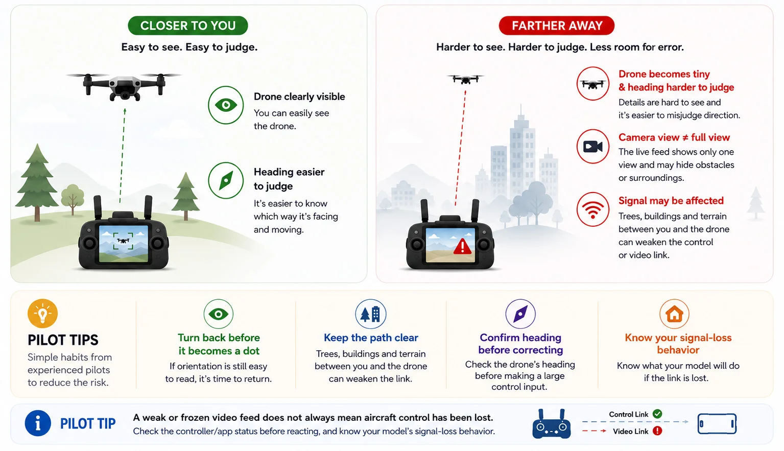
Turn back while the drone is still easy to see and easy to orient—not when it has already become a dot.
Panic Turns Small Problems Into Big Ones
The first problem is not always the event that loses the drone. Sometimes the pilot’s reaction creates the next problem: large stick inputs while unsure of orientation, repeatedly starting and cancelling RTH, changing modes without understanding the result, or continuing to fly while trying to diagnose a warning.
01 · STOP
If the aircraft is stable, stop adding rapid, unrelated control inputs.
02 · CHECK
Check mode, GPS, battery, distance, altitude, orientation and warnings.
03 · CHOOSE ONE ACTION
Use one recovery action appropriate to your model and situation.
04 · WATCH
Confirm the aircraft is responding as expected before doing anything else.
When something feels wrong: stop, identify what the drone is doing, then make one deliberate decision.
Before Every Flight: 7 Questions That Break the Accident Chain
The best recovery often happens before takeoff. A short check can remove several of the conditions that turn a minor problem into a lost aircraft.
1. Is GPS Ready?
Has the aircraft reached the GPS-ready status required by your model?
2. Is the Home Point Correct?
Have you confirmed where the aircraft believes “home” is?
3. Do I Understand RTH?
Do you know the model’s RTH triggers, altitude behavior, failsafe setting and cancellation procedure?
4. Is the Return Corridor Clear?
Look at the route home—not only the takeoff area—for trees, buildings, poles, wires and terrain.
5. Can the Drone Handle the Return Wind?
Think about the wind direction on the way back, not only how easy the outbound leg feels.
6. Do I Have Battery Reserve?
Plan to return with margin for wind, repositioning and landing rather than using the entire battery.
7. What Will I Do If the Link Drops?
Know the expected signal-loss behavior before it happens. Do not discover the failsafe logic during an emergency.
Good pilots do not rely on one safety feature. They remove problems before those problems have a chance to stack together.
GPS Drone Crash & Flyaway FAQ
Can a GPS drone still fly away?
A GPS-equipped drone can still become lost or move somewhere the pilot does not expect. Causes can include an unexpected Home Point, wind, insufficient battery reserve, signal loss, orientation errors or model-specific failsafe behavior. “GPS” should not be treated as a guarantee against loss.
Why would a drone fly in the wrong direction during RTH?
First confirm whether it is actually returning toward the Home Point stored by the aircraft. If that point differs from the location you expected, correct RTH behavior can look like the drone is flying the wrong way. RTH behavior varies by model, so check the manual and flight status information.
Can strong wind stop a drone from returning home?
Yes. A drone may know the direction home but make slow progress—or be unable to make sufficient progress—against wind that exceeds its practical ability to return. Plan outbound distance and battery reserve with the return wind in mind.
Does obstacle avoidance prevent drone crashes?
No sensing system should be treated as a crash guarantee. Detection capability, direction coverage, lighting requirements and difficult obstacles vary by model. Thin branches, wires, transparent or reflective surfaces and obstacles outside sensor coverage can still create risk.
What should I do if I lose orientation?
Avoid making a rapid series of large inputs while you are unsure which way the aircraft is facing. If conditions are safe and the aircraft is stable, identify its state and orientation, then use the recovery procedure appropriate to your model.
What is the best way for a beginner to avoid losing a GPS drone?
Start close in a large open area, confirm GPS and Home Point, understand RTH before relying on it, keep practical battery reserve, respect wind, maintain visual awareness and avoid treating advertised range or automated features as targets to test.
Build Good GPS Habits With a Beginner-Friendly Platform
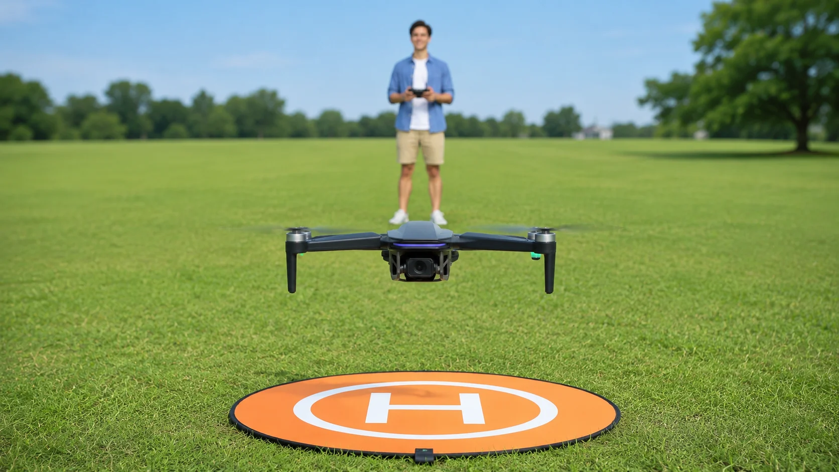
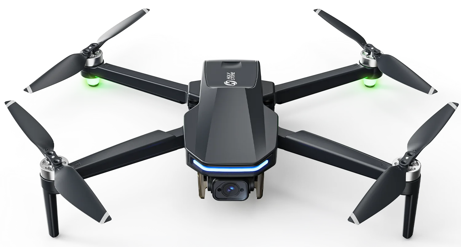
HS175D Plus is designed as an approachable way to practice the habits covered across this beginner GPS series: GPS-assisted flight, Home Point awareness, Return to Home, short orientation exercises and conservative battery planning.
Build the Habits That Keep Small Problems Small
Start with the first-flight basics, then learn exactly how Return to Home works before you depend on it.


COMMENTS