

 Sign in
 Sign up


Drone Return to Home Explained: How RTH Really Works
Drone Return to Home Explained: How RTH Really Works
What happens when you press RTH, lose signal, or run low on battery—and what you should check before takeoff.
Learn how Home Point, return paths, RTH altitude, signal loss, wind and obstacles affect one of the most important GPS drone safety features.
Return to Home can make a GPS drone feel much less intimidating. Press a button—or lose the control link on a model configured for failsafe return—and the aircraft may begin making its way back toward a recorded Home Point.
But RTH is often misunderstood. It does not automatically mean the drone will retrace the exact route you flew out, recognize every obstacle, choose the perfect altitude, or land on the exact same patch of ground every time.
The safest way to use RTH is to understand what the feature can do, what it depends on, and what decisions still belong to the pilot.
RTH knows where “home” is. That does not mean it knows every safe way to get there.
What Does Return to Home Actually Do?
Return to Home is a GPS-assisted recovery function designed to bring the aircraft back toward a recorded Home Point. The exact sequence varies by drone, but the basic idea is simple: the aircraft needs a reliable position, a valid Home Point, enough remaining power, and a return route that does not create a new problem.
1. The Drone Knows Its Position
A GPS-capable drone first needs usable satellite positioning so it can understand where it is relative to the recorded Home Point.
2. RTH Is Triggered
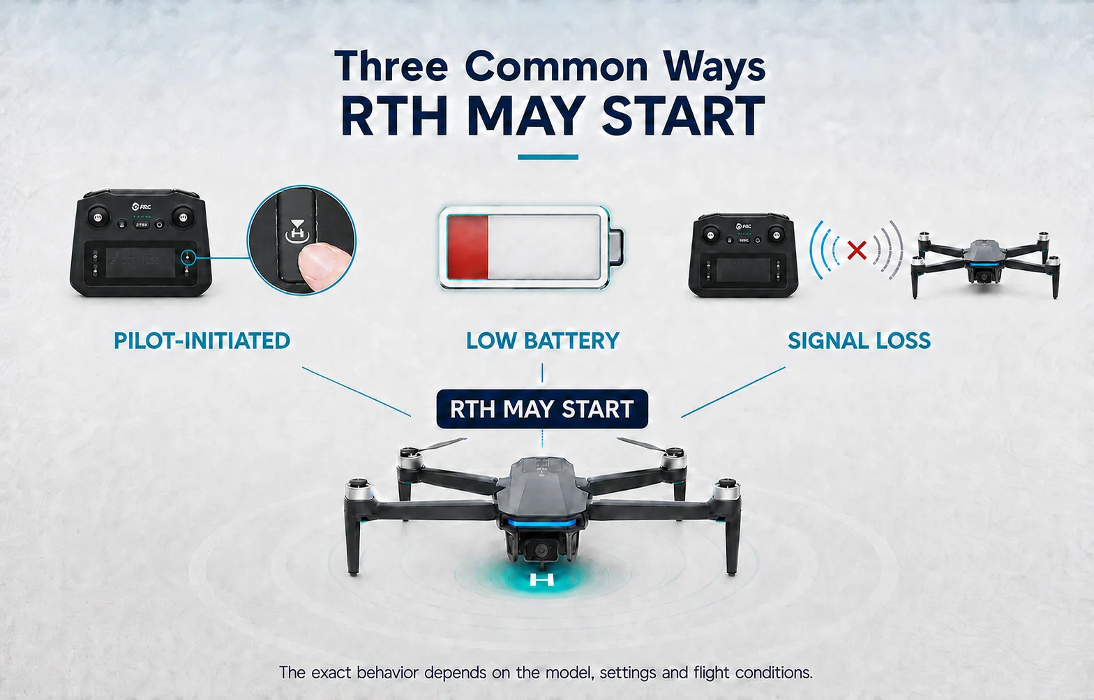
Depending on the model, return may be started manually, after a control-link loss, or when the aircraft reaches a battery-related return condition.
3. The Aircraft Executes Its Programmed Return
It may climb, maintain altitude, return more directly, or use another model-specific RTH behavior before descending near the Home Point.
RTH behavior is model-specific. Do not assume one drone behaves exactly like another. Check the manual for your aircraft before relying on the feature.
Before RTH Can Work Well, the Drone Needs the Right Home Point
One of the easiest beginner mistakes is taking off as soon as the aircraft and controller connect. A connected drone is not necessarily ready for a GPS-assisted return.
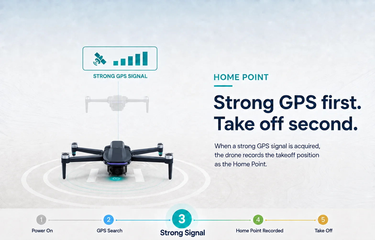
Give the aircraft time to acquire the GPS status required by your model. On many GPS drones, a strong GPS signal allows the aircraft to record its takeoff position as the Home Point before it leaves the ground.
On some models, landing and taking off again from a new location may update the recorded Home Point. Check the status shown by your controller or app instead of assuming the original point is still active.
Before takeoff, confirm three things: the required GPS-ready status is shown, the recorded Home Point is correct, and the return area is likely to remain clear.
If GPS status, Home Point recording and your pre-takeoff routine are still new to you, start with How to Fly a GPS Drone for the First Time before relying on RTH farther from home.
Three Common Ways Return to Home May Start
Many GPS drones use some version of the following RTH situations, although the exact names, thresholds and behavior vary by model.
RTH May Not Follow the Route You Flew Out
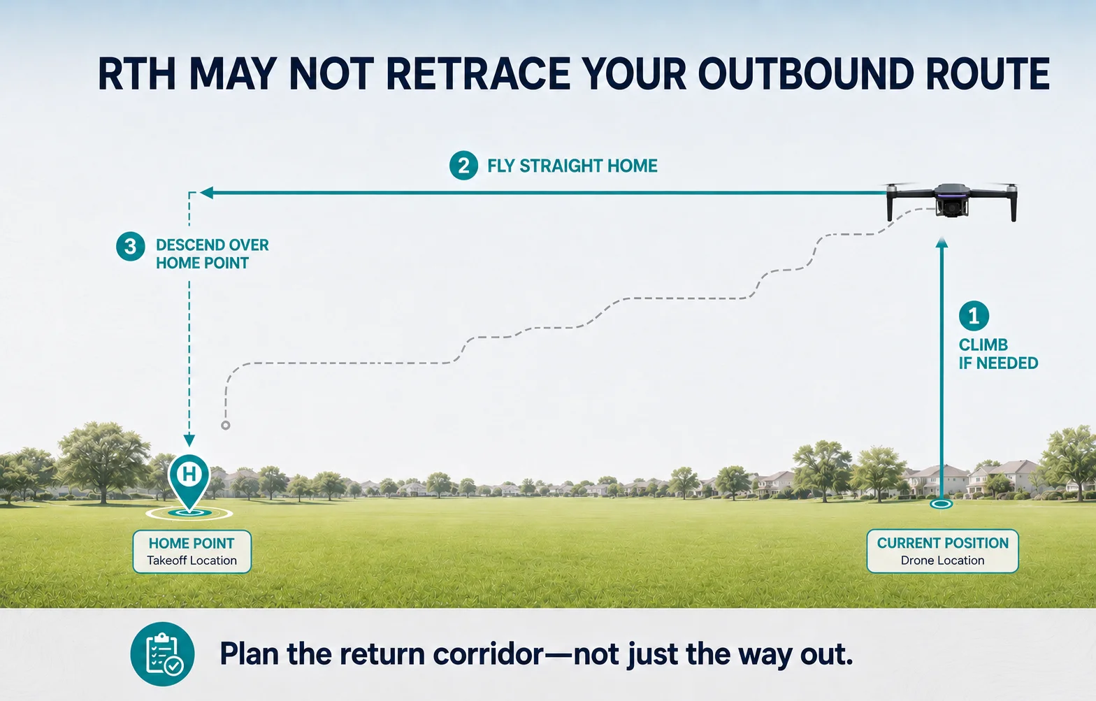
Imagine flying around a tree, past the side of a building and then out into an open field. It is tempting to assume that RTH will simply reverse every turn you just made.
That is not a safe assumption. A common RTH pattern is to climb vertically when required, fly horizontally toward the Home Point and descend above it. This direct return can be very different from the turns you made while flying out.
A safe outbound route does not automatically guarantee a safe return route.
Exact RTH behavior varies by model, distance, altitude and selected mode. Always check your drone's user manual before flight.
RTH Altitude: Plan for the Route, Not Just the Takeoff Spot
RTH altitude should be planned for the route home—not just the area around the takeoff point. Depending on the model and its distance from the Home Point, the preset altitude may not be used in every RTH situation.
Before takeoff, look at the entire area between the aircraft and Home Point and choose an altitude that gives the return path practical clearance.
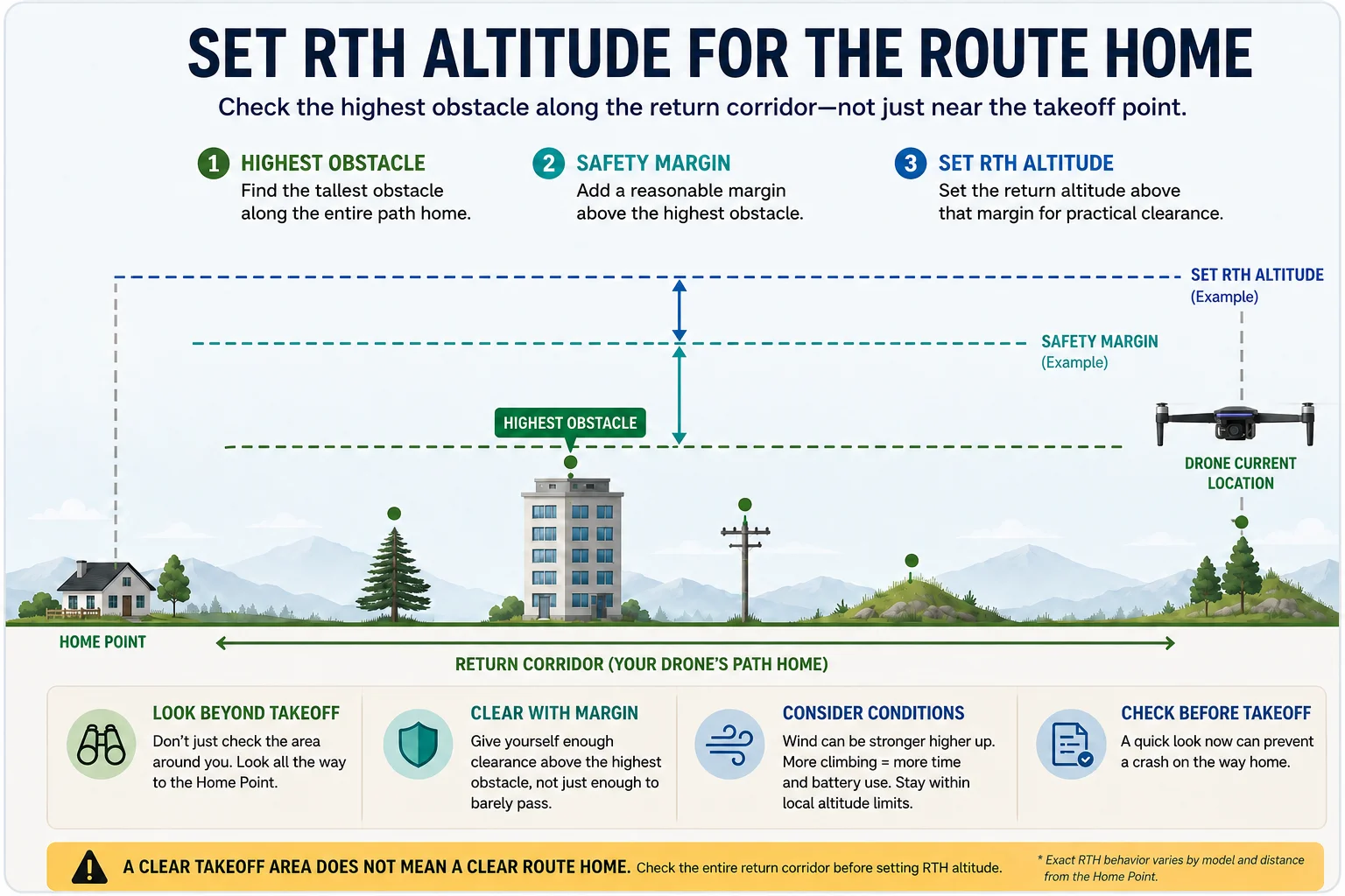
01 · Check the Return Corridor
Look beyond the takeoff spot. Identify trees, buildings, poles, terrain and other obstacles that could lie between the aircraft and Home Point.
02 · Set Enough Clearance
Choose an RTH altitude that clears the relevant obstacles along the return route with a reasonable safety margin.
03 · Consider Wind and Limits
Avoid setting an unnecessarily extreme altitude. More climbing can take additional time and battery, and wind conditions may be different higher up. Always stay within applicable altitude limits.
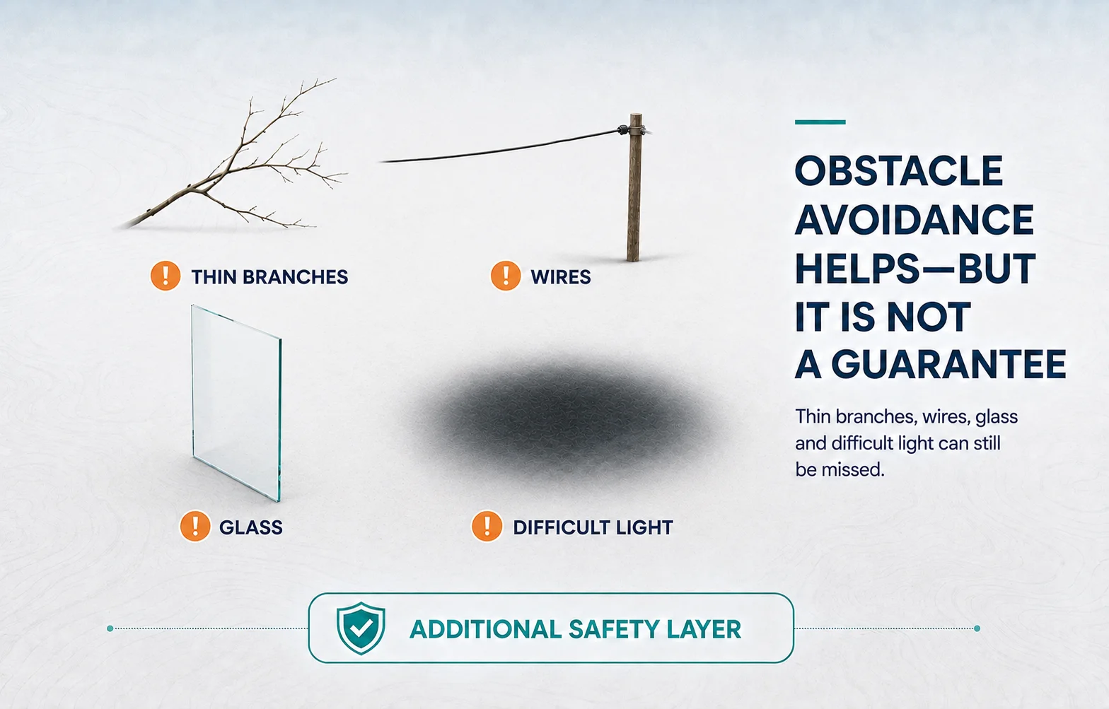
Obstacle Avoidance Helps—but It Is Not a Guarantee
Some higher-end drones include obstacle sensing or obstacle avoidance systems. These features can reduce collision risk, but they should not be treated as an invisible protective bubble around the aircraft.
Many GPS drones, especially beginner models, do not have obstacle sensing during RTH. Even drones equipped with it can struggle with thin branches, bare twigs, wires, transparent or reflective surfaces, low-detail objects, poor lighting, strong backlight and obstacles outside the sensors’ coverage.
The safer approach is to plan a return route that does not depend on obstacle avoidance to prevent a collision.
First Layer: Pilot Planning
Know what lies between the aircraft and Home Point before you fly away.
Second Layer: RTH Altitude
Use an appropriate return altitude to clear the major obstacles you can identify.
Third Layer: Obstacle Sensing
If your drone has it, treat sensing as an additional safety layer—not a substitute for the first two.
Signal Loss Is Something to Plan for Before It Happens
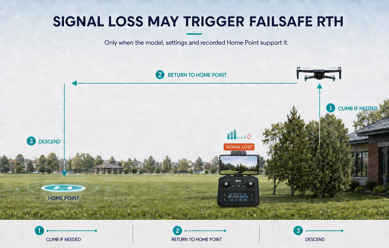
A frozen live view or lost control link can feel alarming, especially on an early flight. That is exactly why the worst time to learn your drone's failsafe behavior is after the signal disappears.
Failsafe RTH generally depends on the aircraft's selected signal-loss response and may also require usable GPS positioning, a valid Home Point and normal compass operation. Other models or settings may hover or land instead of returning.
When You Should Not Blindly Rely on RTH
RTH is most useful when the route home is predictable. In some environments, automatically starting a return can create a new risk.
Under a Tree Canopy
Depending on the model, distance and current altitude, an automatic climb can move the aircraft toward branches directly above it.
Under or Near Structures
Bridges, overhangs and enclosed spaces can make vertical or direct-return movement unsafe.
Poor GPS Environment
RTH depends on reliable positioning. Follow warnings and model-specific guidance when GPS is weak or unstable.
Unclear Home Area
If people, vehicles or obstacles have moved into the landing area, automatic descent may no longer be the safest choice.
Why RTH Can Still Fail
RTH can be working exactly as programmed and still fail to bring the aircraft safely home. These three situations show why the return result depends on more than the RTH function itself.
01 · Tailwind Out, Headwind Home
Situation: A tailwind makes the outbound flight easy, so the drone travels farther than expected.
During RTH: The return becomes a headwind flight. Ground speed drops while power use rises.
Lesson: RTH can point the drone home, but it cannot guarantee enough power to overcome the wind and complete the return.
02 · The Home Point Was Wrong or Unexpected
Situation: The recorded Home Point was not the location the pilot expected.
During RTH: The aircraft may return correctly—to the recorded point rather than the place the pilot had in mind.
Lesson: RTH can work correctly and still return to the wrong place.
03 · The Direct Return Path Was Blocked
Situation: The outbound flight went around trees, buildings or other obstacles.
During RTH: The programmed return may use a more direct corridor.
Lesson: A safe outbound route does not automatically mean the programmed route home is safe.
RTH is only one part of the safety picture. See how wind, battery, Home Point, obstacles, signal and pilot reactions can combine in Why GPS Drones Crash or Get Lost: What Beginners Often Get Wrong.
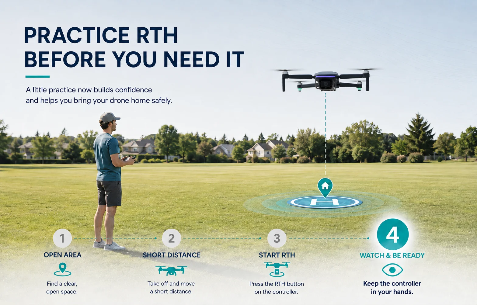
Practice RTH Before You Actually Need It
Choose a wide open area with good GPS conditions and mild weather. Keep the drone close, clearly visible and well away from obstacles. Then learn what your own aircraft actually does.
A 20-Second RTH Check Before Every Flight
Before takeoff, use this quick check to confirm that the aircraft, return settings and route home are ready for the conditions around you.
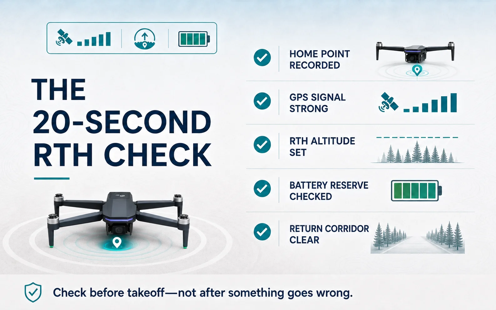
Good RTH starts before the drone leaves the ground.

A Beginner GPS Drone for Learning RTH Habits
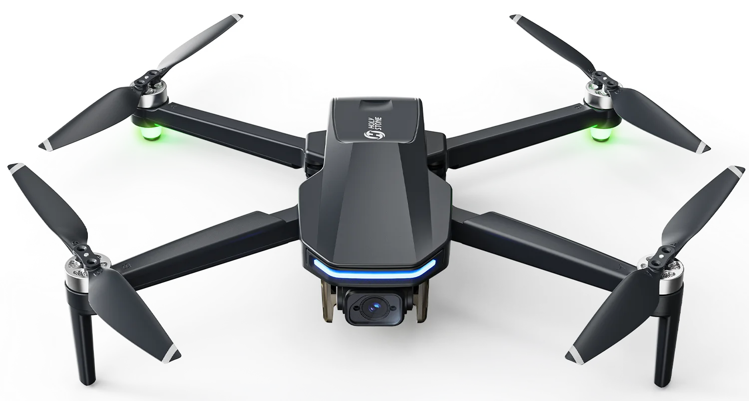
The HS175D Plus is an entry-level GPS drone that gives new pilots a practical way to learn Home Point awareness, Return to Home, short-distance flight planning and early-return habits in open outdoor spaces.
Drone Return to Home FAQ
Does Return to Home bring the drone back to the exact takeoff spot?
Not necessarily. RTH is intended to return the aircraft toward the recorded Home Point, but final positioning and landing accuracy can vary by model, signal quality and operating conditions.
Will RTH avoid every tree or building?
No. Some drones have no obstacle sensing, while drones that do have sensing still have detection limits. Plan a clear return route and use an appropriate RTH altitude rather than relying on sensors alone.
Should I set RTH altitude as high as possible?
No. It should be high enough to provide appropriate clearance for the environment while also considering wind, battery use, terrain, local rules and the aircraft's capabilities.
Does a drone always return home after signal loss?
Not always. Signal-loss behavior varies by aircraft and may depend on the selected failsafe setting, GPS availability, the recorded Home Point and compass status. Some models can be configured to return, hover or land. Check your model's manual and settings before flight.
Can I cancel RTH and fly manually?
Many GPS drones allow the pilot to cancel Smart or Failsafe RTH and resume manual control, but the exact method varies by model. A battery-critical automatic landing may not be cancelable. Practice the permitted procedure in an open area before relying on it in a stressful situation.
Can the recorded Home Point change after takeoff?
It can on some models. If the drone lands at a new location and takes off again, that new takeoff position may become the newly recorded Home Point. Always confirm the active Home Point before continuing the flight.
When should a beginner practice RTH?
Practice after you are comfortable with takeoff, hovering and basic orientation. Use a wide open area, keep the drone close and visible, and test the feature while battery and conditions are still comfortable.
Build Better GPS Drone Habits
If you are still learning the basics, start with a first-flight routine. Then see how Home Point mistakes, wind, battery, obstacles, orientation and pilot reactions can combine into a crash or lost-drone situation.


COMMENTS